Soil type is an important variable for volumetric water benefit calculations because different soils transmit water in different ways. For example, a porous well-drained soil will allow more water to infiltrate the ground and recharge groundwater than a hard, impermeable soil generating more runoff. Soil also plays a crucial role when it comes to agriculture and the success of certain types of projects.
The VWB Accounting Standard (Reig et al, 2019) and Soil and Water Assessment Tool (Neitsch et al, 2011) refer to the four hydrologic soil groups (HSGs) according to the US Soil Conservation Service classification.
Based on the Natural Resources Conservation Service Part 630 Hydrology National Engineering Handbook, Chapter 7 Hydrologic Soil Groups (2007), the four groups include the following:
Group A soils are composed of deep, well-drained sand or gravel and have high infiltration rates when wet. The water passes through quickly, leading to a low runoff potential. Soil: >90% sand or gravel, <10% clay with sand or gravel textures.
Group B soils are composed of medium to deep layers with well-drained textures ranging from slightly fine to coarse. They have a medium rate of water infiltration when wet and allow water to pass through them at a moderate rate. Soil: 10-20% clay, 50-90% sand with loamy sand or sandy loam textures.
Group C soils have slow infiltration rates when wet. These soils are primarily composed of either (1) soils with a layer that hinders water movement, or (2) soils with moderately fine to fine textures and slow infiltration. They transmit water very slowly. Soil: 20-40% clay, <50% sand with loam, silt loam, sandy clay loam, clay loam, and silty clay loam textures.
Group D soils have very slow infiltration rates when wet. These soils include swelling clayey soils, high constant water table, surface clay layers, or shallow soils over near-impervious materials. They transmit water very slowly. Soil: >40% clay, <50% sand, clayey textures.
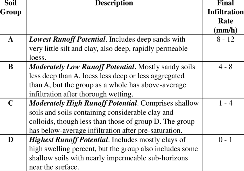
The table below describes each soil group in terms of runoff potential and infiltration rate (Stone, 2014):
HSGs can be identified using local soil composition data based on soil sampling or publicly available data such as the HYSOGs250m global gridded dataset.